home | contents | previous | next | index
Chapter 13 - Arylle and Luatha
In this chapter, I'm going to make some seemingly disparate observations, and then at the end I'll tie them together. Please bear with me.
First of all, here is the area I'll be discussing as shown on Steve's Map:
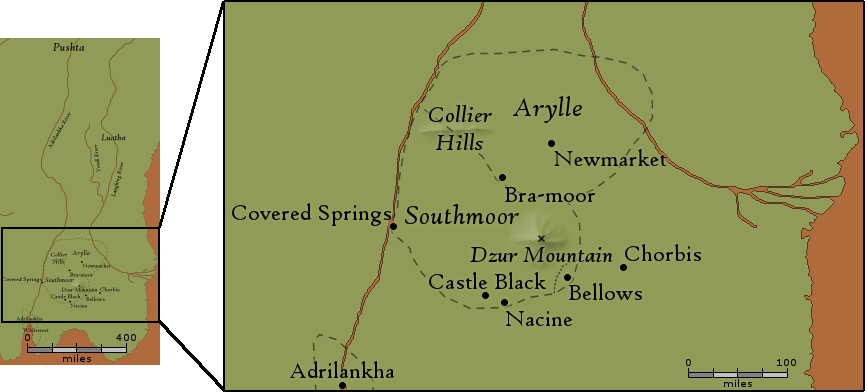
The Southeast on Steve's Map
As you can see, the Duchy of Arylle's borders are shown on Steve's Map, but Luatha is just labeled (it's hard to read in the small image on the left, but Luatha is written about halfway up the Laughing River on the right).
However, Paarfi tells us that Arylle and Luatha share a border:
Brachington's Moor ... the chief residence of the County of Bra-Moor, the seat of the Duchy of Arylle [is] an unlikely place. It comprises eleven counties of neat, elegant farmland, with the southernmost, called Groomsman, extending to a point abutting the Duchy of Luatha on the edge of the Great Plains.
A quick aside: I think Paarfi misspoke when he wrote that "the southernmost [county], called Groomsman, extending to a point abutting the Duchy of Luatha"; I think he means that Groomsman is the northermost county.
When Sethra is explaining to Zerika et al how to get from Dzur Mountain to Deathgate Falls, she says that this border is also the transition point from jungle (to the south) to plains (to the north):
[Dzur Mountain is] about midway between the Adrilankha River and the Eastern River. Either would be suitable for a southward journey, but ... you will be going north ... there is a road through the jungle ... that crosses the Eastern River ... at a good ford. The road then turns east to the Shallow Sea, but if you continue north [you will] find a road running through the jungle [to] Wilder [on] the edge of the Pushta
Paarfi says the political border is at "the edge of the Great Plains" and Sethra says Wilder is a location on "the edge of the Pushta", so that puts Wilder on the border between Arylle and Luatha. Since they will get to it after crossing the Laughing River, it's also to the northeast of the Laughing River:
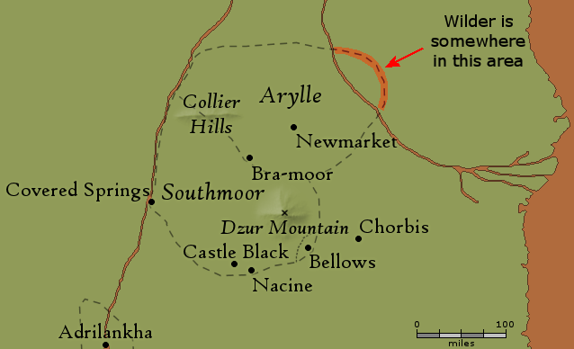
Wilder's Location
When Morrolan et al make a similar trip in reverse (traveling from the East to the future home of Castle Black), they follow a road that appears to run in this same general area:
[After leaving Keybrook] They traveled in this way as the days and weeks wore on, and the mountains, which were ever upon their right hand, began to seem lower and lower ... It was eight or nine days later that they awoke to discover that the ... Eastern Mountains, were no longer upon their right hand, replaced with only the most harmless-looking hills. Morrolan and his friends looked back to the north, and saw, as it were, the trailing edges of the mountains. ... I nearly imagine ... that I can smell the sea, although it is yet more than fifty leagues distant ... There, between those hills. Do you see? / it looks ... to be a small troop of horsemen ... they are elfs ... they do not appear to be coming in our direction ... they are going north ... Let them alone then ... Southward, and a bit to the west [to Southmoor]
It was on a Firstday in the summer of the two hundred and forty-seventh year of the Interregnum that Morrolan arrived in the county of Southmoor, and, more particularly, a small barony called Bellows, located along its eastern border ... although the county was named Southmoor, this appellation was largely unearned. Although there are moors, swamps, and marshes in plentiful supply in the deltas and wetlands to the north, Southmoor in general consists of jungles, tropical rain forests, and some land suitable ... for [farming]. The name, we should add, came from the one moor to be found in the region, a small one in its northeastern corner, but the first area to be settled. They happened to meet a peasant as they followed the road from Chorbis, the village where they had managed to find an inn the night before.
there are the ruins of [a floating] castle nearby [from Bellows] Perhaps sixty or seventy miles west of here ... Then let us go there ... ten or eleven hours after setting out, they had traveled some fifteen leagues, bringing them, at the end of that time, to the wall that circled the village of Nacine, on the Hightower Brook
This suggests that there is a road that runs south between the Laughing River and the Shallow River all the way to Chorbis, and from there to Bellows, and from there to Nacine.
To remind you, here is how Paarfi/Sethra describes the road Zerika is to take on her journey northward:
there is a road through the jungle ... that crosses the Eastern River ... at a good ford. The road then turns east to the Shallow Sea, but if you continue north [you will] find a road running through the jungle [to] Wilder
I don't think that first road starts on Dzur Mountain itself; it probably runs either east or west of Dzur Mountain. As I've already established, there appears to be a road running north of Bra-moor to Undauntra's Highway; that road does not appear to go anywhere near the Laughing River, so I think the road Zerika took is to the east of Dzur Mountain, and that's also the location of the road Morrolan took.
While it's certainly possible that there are two roads that run north to the east of Dzur Mountain, a simpler explanation is that these are the same road.
That means this road runs from Nacine to Bellows to Chorbis to a good ford across the Laughing River, where it turns east. Just a little ways north of there, the road continues through Wilder to the north.
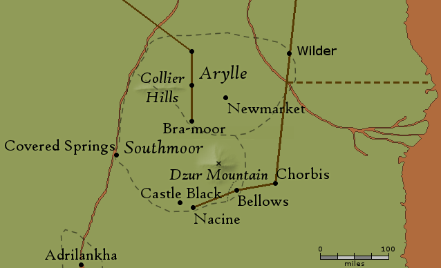
Southeastern Road
Rafts
Another potential stop along this road is Rafts (a village, a barony and a castle):
There is a place on what is usually called the Laughing River but is known to the locals as the Deepwater about a hundred miles above where the Yendi River joins it. Here, along the banks, there is a village called Rafts, overlooked by a tall castle ... Doscava, Baron of Raft,
That straightline road from Chorbis to Wilder crosses the Laughing River exactly 100 miles north of where the Yendi River flows into the Laughing River.
home | contents | previous | next | index
Questions? Comments? Please contact me at dragaera [at] bryann.net.
Copyright © 2020 Bryan Newell, unless otherwise noted.